30-150 Minutes
Hike, cycle, or ride through Fort Ord National Monument
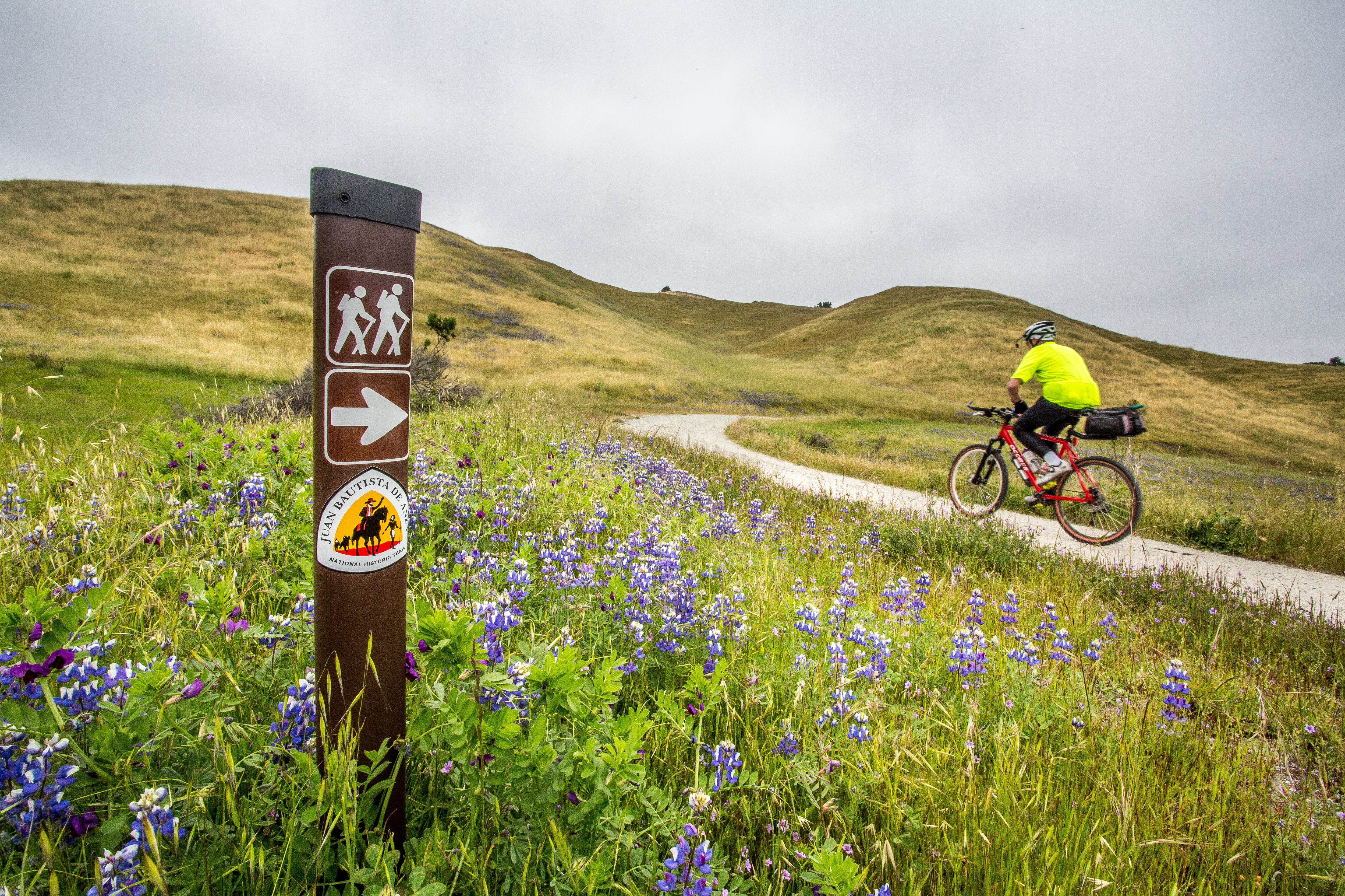
Juan Bautista de Anza National Historic Trail
Hike or ride a strenuous 4.5-mile segment that crosses the majestic grasslands of Fort Ord National Monument. The Monument segment is anchored by the Creekside Terrace Trailhead and the Badger Hills Trailhead where restrooms, maps, and interpretive displays are provided. The Creekside Terrace Trailhead has potable water.
Travel back in time to March 10, 1776, when Anza expeditioners left their campsite in what is now the Salinas Valley. They passed through the river valley towards the Royal Presidio of the port of Monterey. This 4.5-mile segment crosses the majestic grasslands of Fort Ord National Monument. The trek offers a nostalgic look of what the native grasslands looked like prior to large-scale European expansion and settlement. The non-motorized segment spanning the Monument complements the Anza Trail auto tour segment of State Route 68 and parallels the El Toro Creek terraces, which were known to support some small settlements of the native Ohlone people. The Monument segment is anchored by the Creekside Terrace Trailhead and the Badger Hills Trailhead where restrooms, maps, and interpretive displays are provided. The Creekside Terrace Trailhead has potable water. Brochure and trail map: Fort Ord 2022 Brochure
Tags
BikingColonization and SettlementExplorers and ExpeditionsGrasslandsHispanic American HeritageImmigrationLatino American HeritageMigrationsMilitaryMonuments and MemorialsNative American HeritageTrailsFort Ord National MonumentBureau of Land Managementblmanza expeditionanza trailSalinas ValleyOhloneCreekside TerraceBadger Hills
Visitor Photos
No visitor photos yet
Details
Duration
30-150 Minutes
Duration Details
By foot and hoof, this segment is a moderately strenuous 2.5-hour trek. By mountain bike, the stretch takes about 30 minutes.
Fees Apply
No
Seasons
Winter, Spring, Summer, Fall
Time of Day
Day, Dawn, Dusk
Accessibility
This is a narrow non-motorized dirt road with elevation gain.
Pets
Yes — Pets allowed on a leash 6' long or shorter.
Reservations
No — None required. However, organized/advertised, commercial and competitive use of the route may require a Special Recreation Use Permit.
Location
Creekside Terrace Trailhead