Overview
About Chiricahua National Monument.
Explore rhyolite pinnacles and balanced rocks on foot or by car. Relax at the campground under star-filled, dark skies. See how a mountain range rising between two deserts creates a home for diverse wildlife. Imagine history here. Prehistoric peoples, Apaches, Buffalo Soldiers, Civilian Conservation Corps, ranchers, and homesteaders inhabited Chiricahua.
Auto and ATVScenic DrivingAstronomyStargazingCampingFoodPicnickingHikingJunior Ranger ProgramWildlife WatchingBirdwatchingPark Film
Weather
The park elevation goes from 5,124 feet at the entrance to 7,310 feet on Sugarloaf Mountain. The top of the park can be 5-10 degrees cooler and windier than the visitor center and entrance. The higher elevations generally have more sun exposure. Clothing layers are always recommended here. The park is often cooler than cities in Arizona with summer highs in the 80s and 90s. Winter lows are often near or below freezing.
Gallery
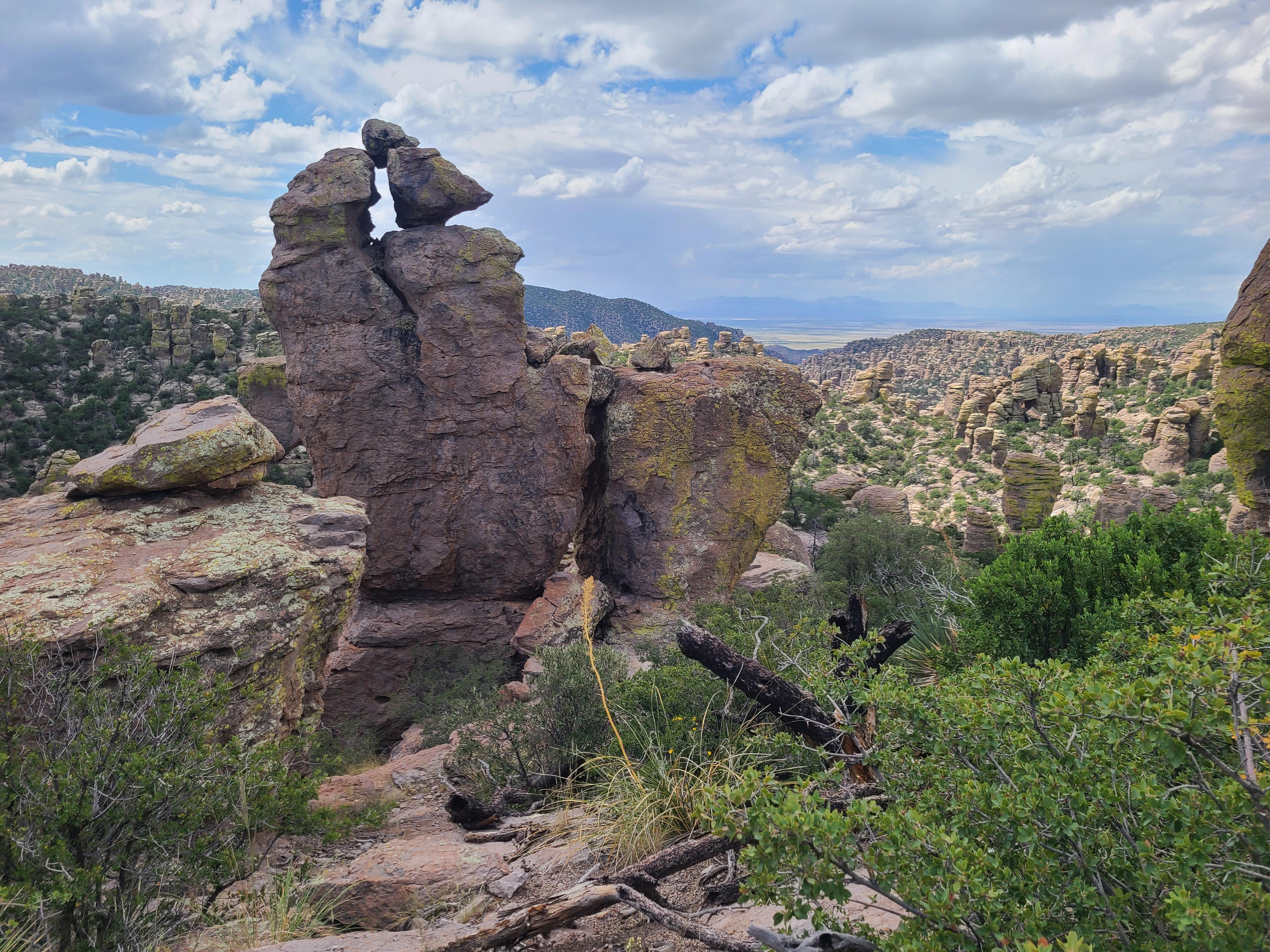
Photos of Chiricahua National Monument.
5 images
Things to do
Discover Chiricahua National Monument.
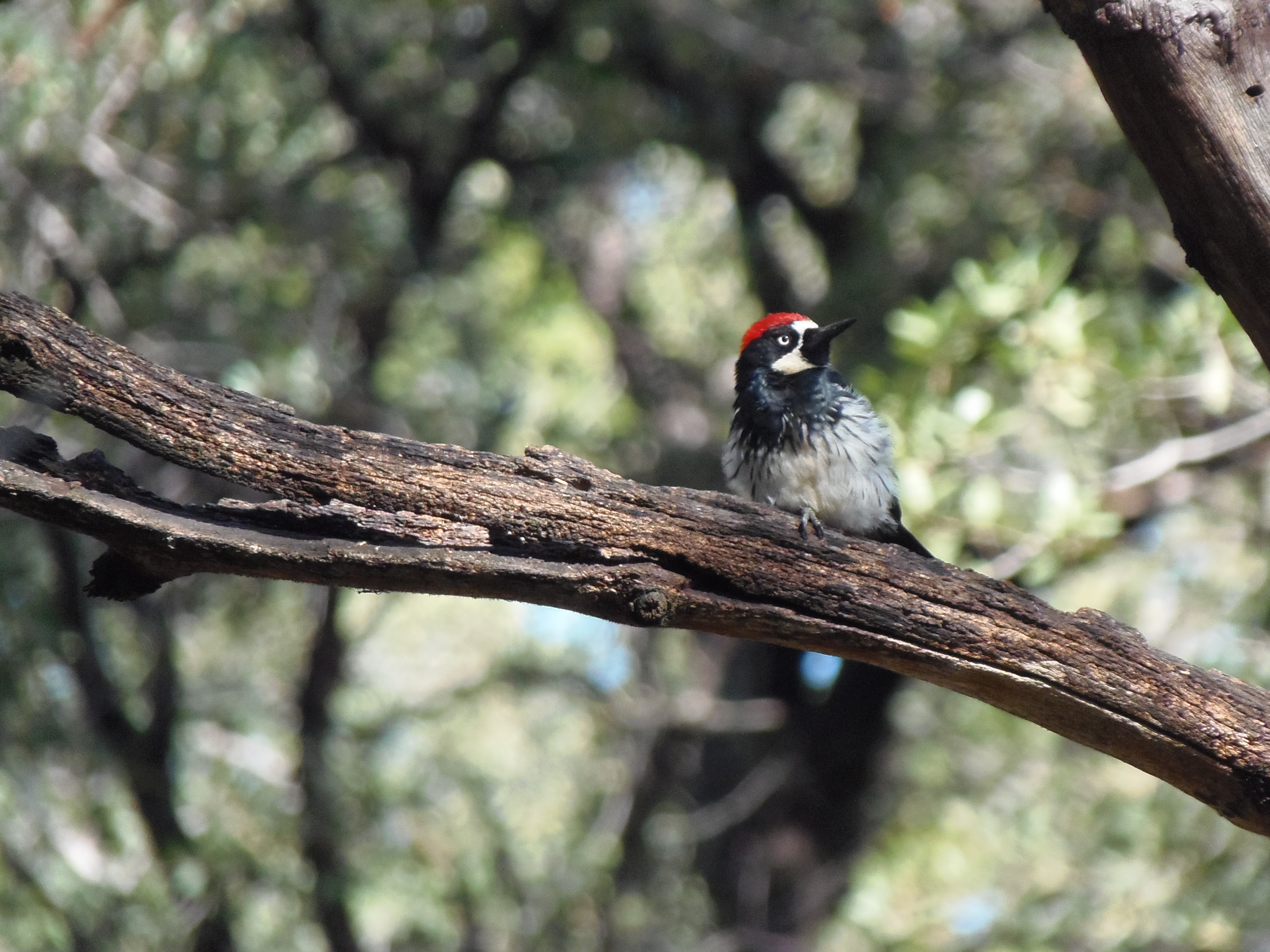
Birdwatching at Chiricahua
Chiricahua is a haven for birdwatchers, with over 200 different bird species documented in the area! The best places for birdwatching in the monument include Bonita Creek Trail, Silver Spur Meadow Trail, and Echo Park, although you'll see birds anywhere in the monument.
Learn more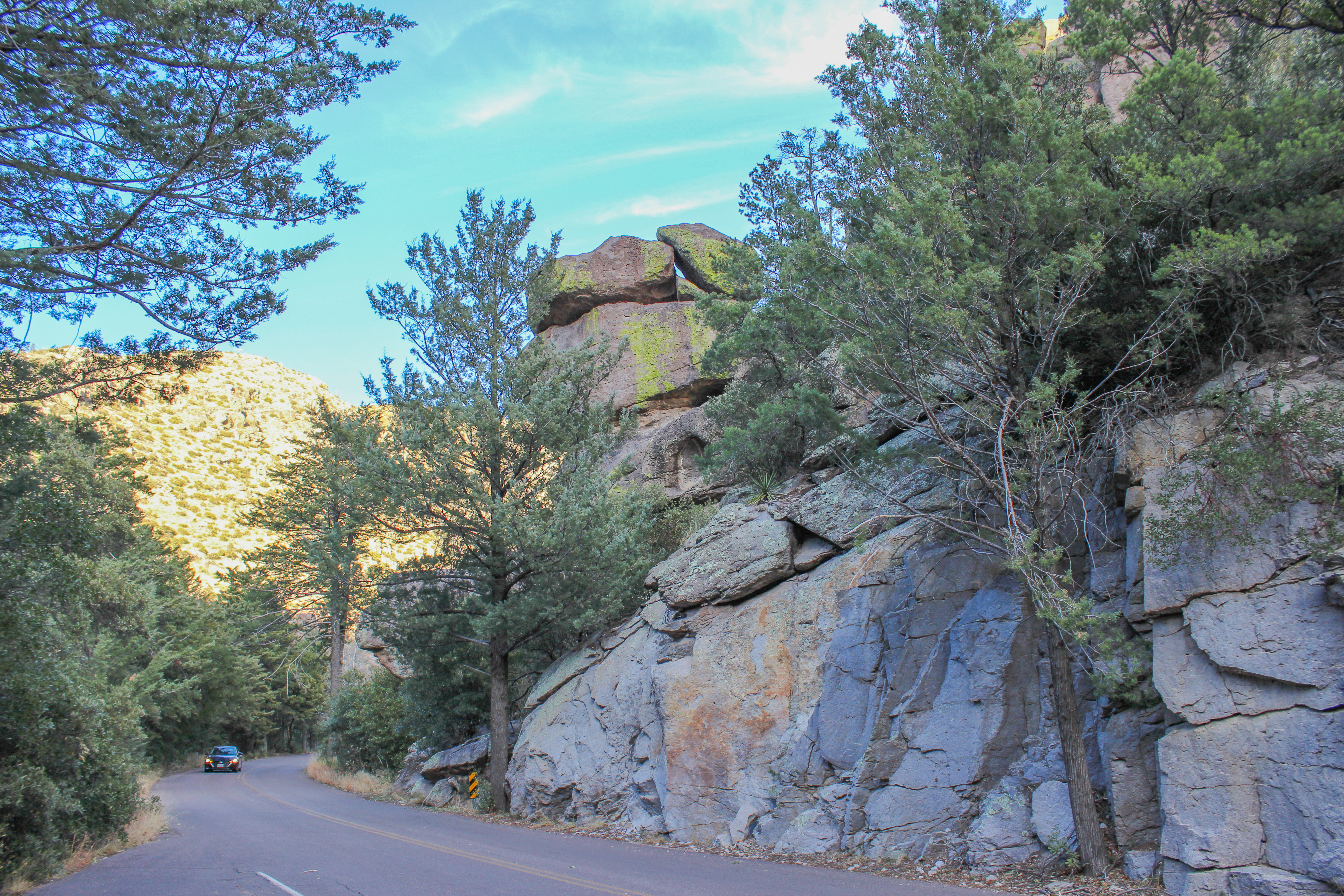
Bonita Canyon Drive
60-90 MinutesThis 8-mile paved drive winds up the valley through rock formations, oak, cypress, and pine forests, to Massai Point. Massai Point overlook has a 360-degree view of the Wonderland of Rocks and the surrounding valleys and mountains.
Learn more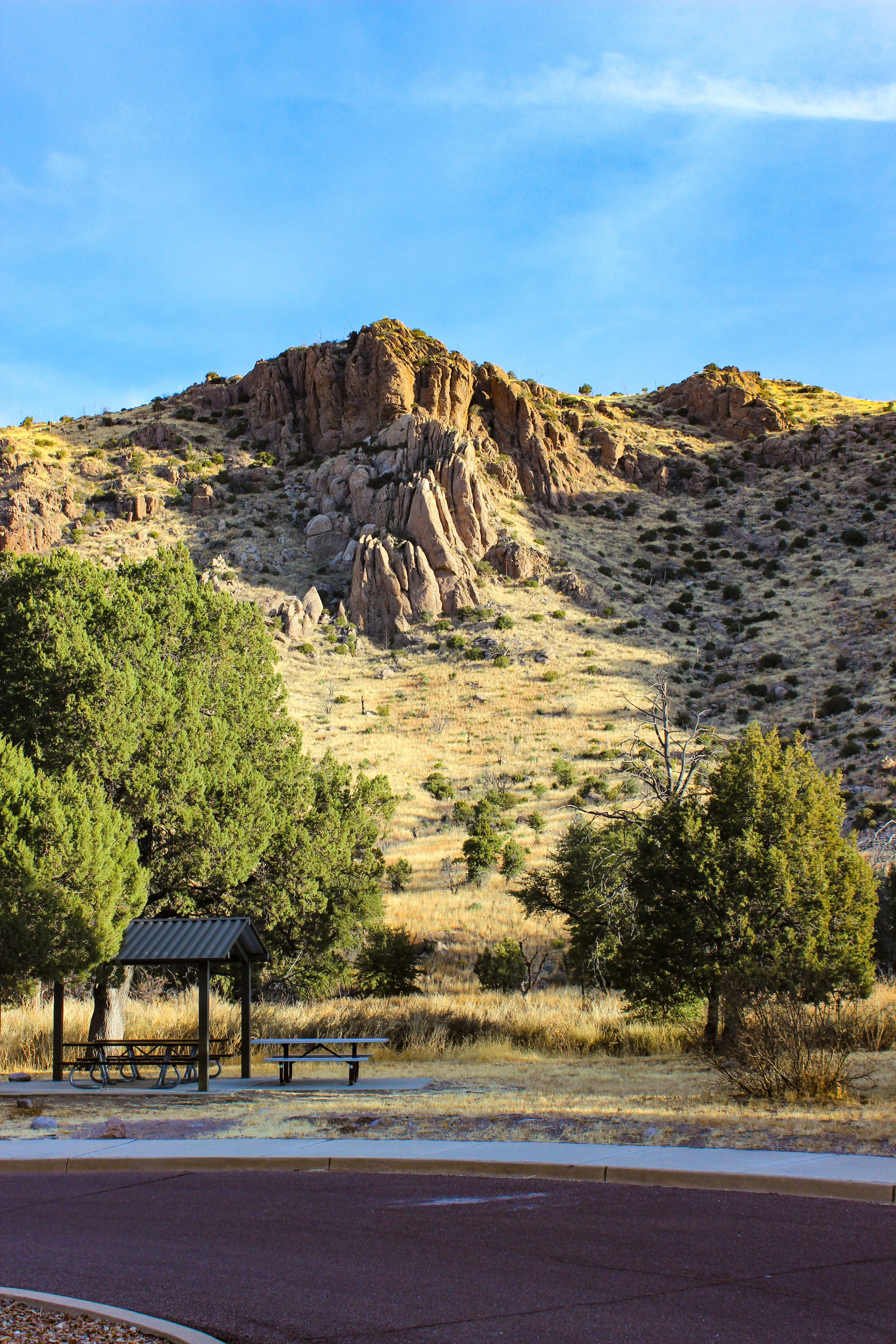
Bonita Creek Loop
15-30 MinutesThis Bonita Creek loops around the picnic area and takes you along the intermittent Bonita Creek. Watch for Apache plume and prickly poppy flowers in spring and early summer. Arizona whitetail deer are frequently seen in the lower portion of Bonita Canyon. This is a good trail to view grassland birds.
Learn more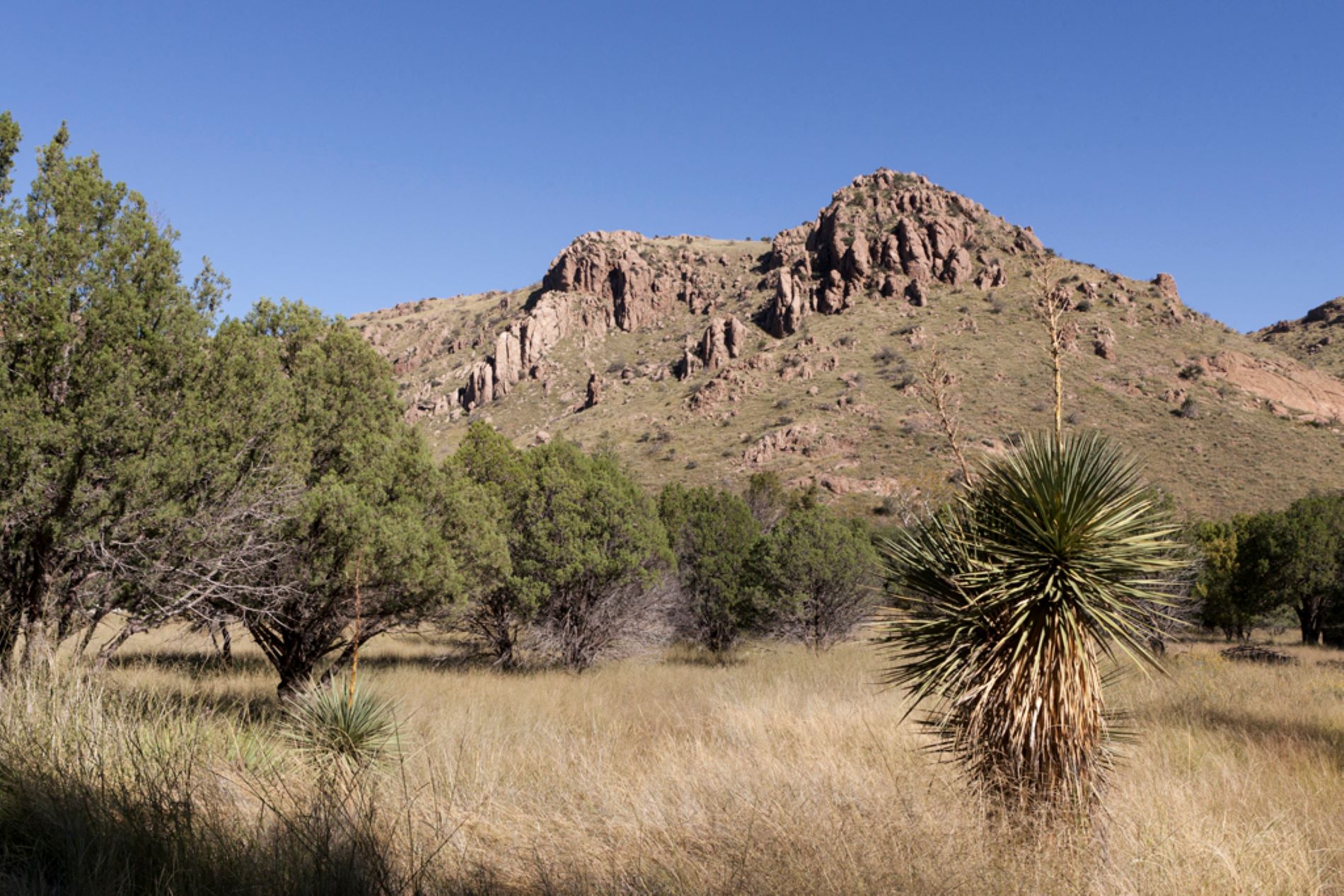
Bonita Creek Trail
30-60 MinutesWinding along Bonita Creek, usually dry, this trail connects the Bonita Creek and Faraway Ranch Picnic Areas. Look for wild animals, including migrating birds, deer, coatimundi, and javelina. This is an easy 1/2 mile trail.
Learn more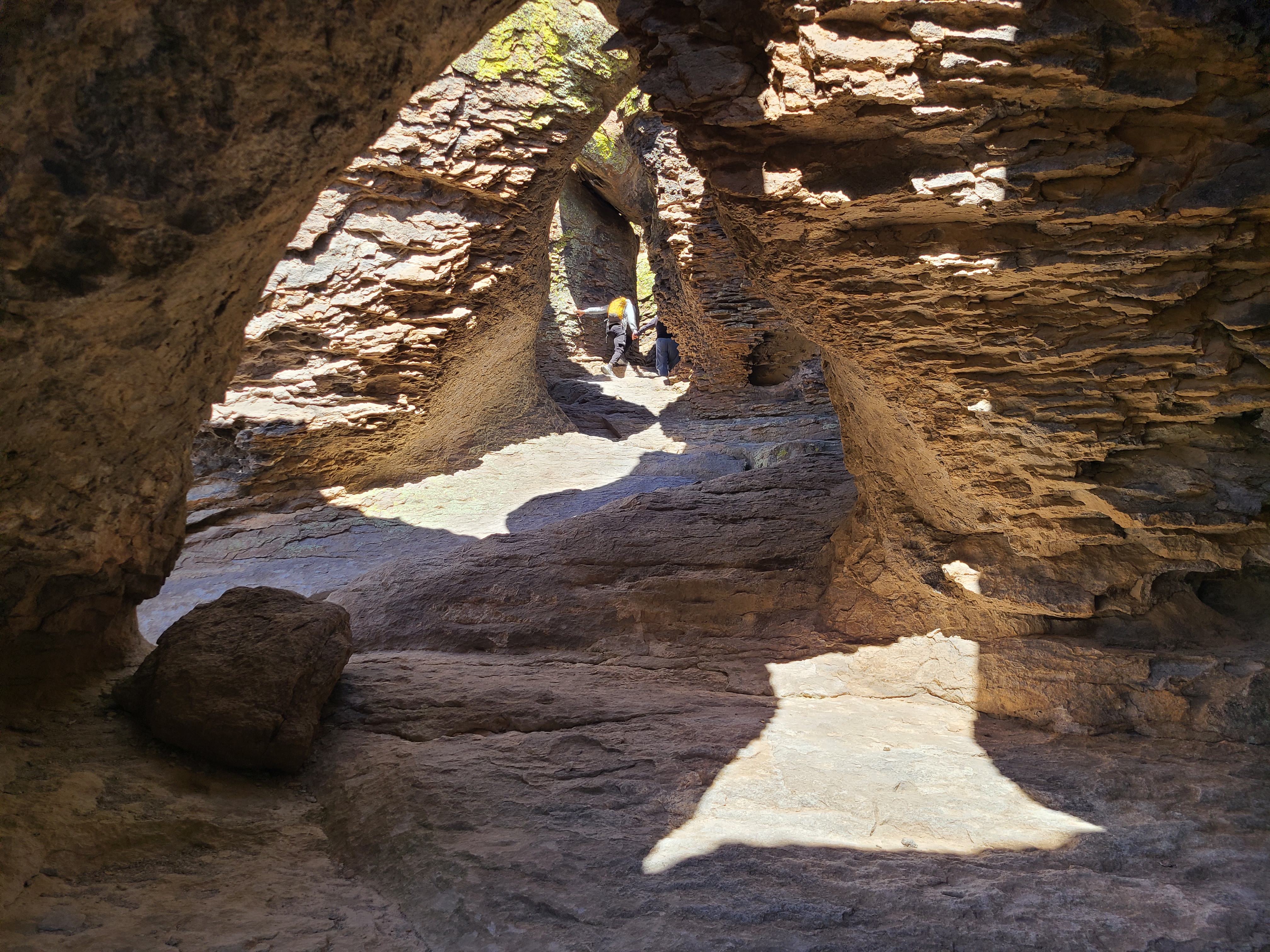
Echo Canyon Grottoes
30-60 MinutesJust 1/2 mile from the parking area, on the Echo Canyon Trail, visitors can be amazed by the tunnel-like rock formations. The Echo Canyon Grottoes are a great option for those who want to experience the rocks but have limited time or mobility.
Learn more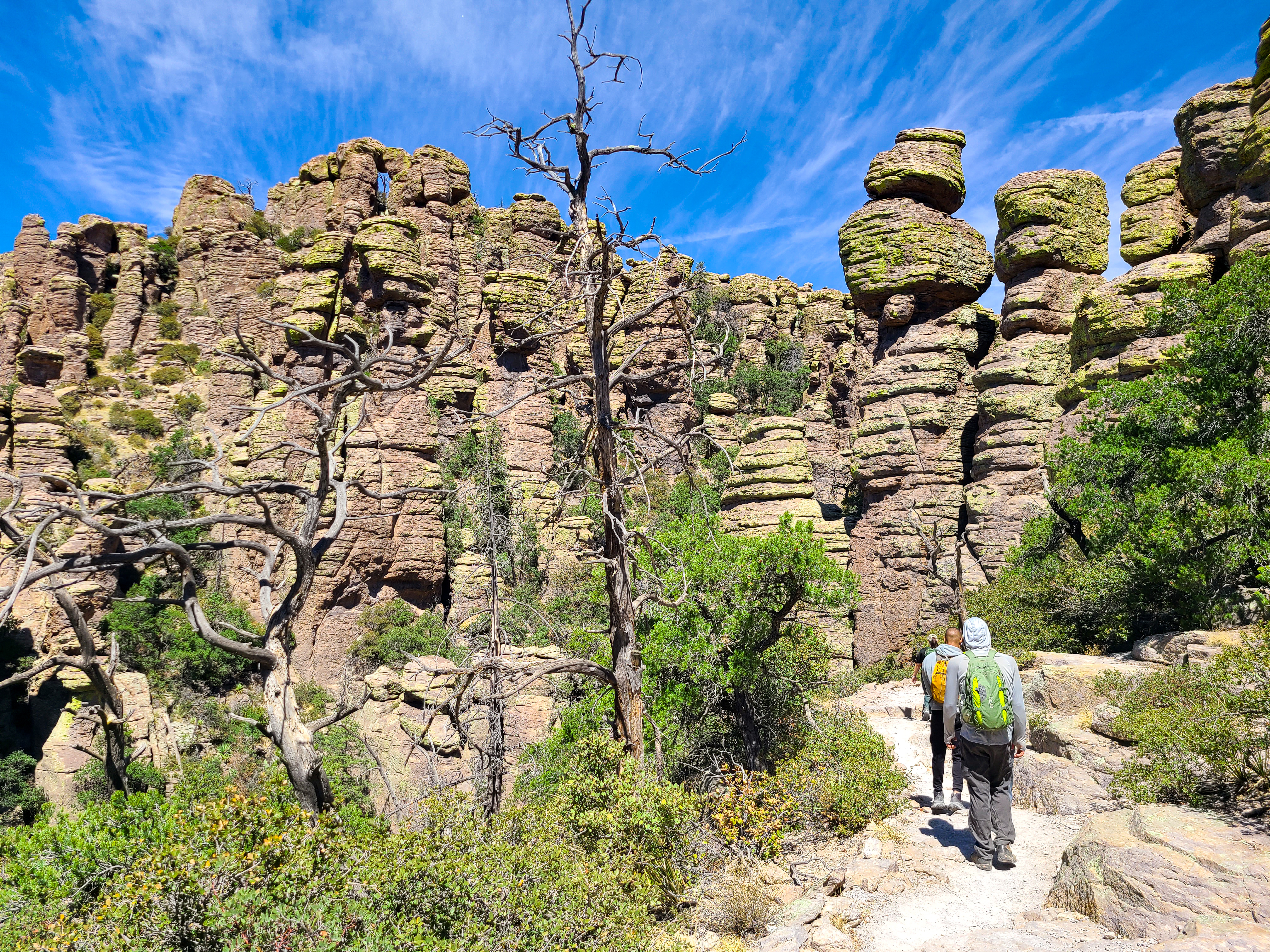
Echo Canyon Loop Trail
2-4 HoursThe most impressive moderate hike in the park. Hike 3.3 miles through balancing rocks, the unique tunnel-like grottoes, narrow slots, and below cliffs of towering pinnacles. No pets.
Learn more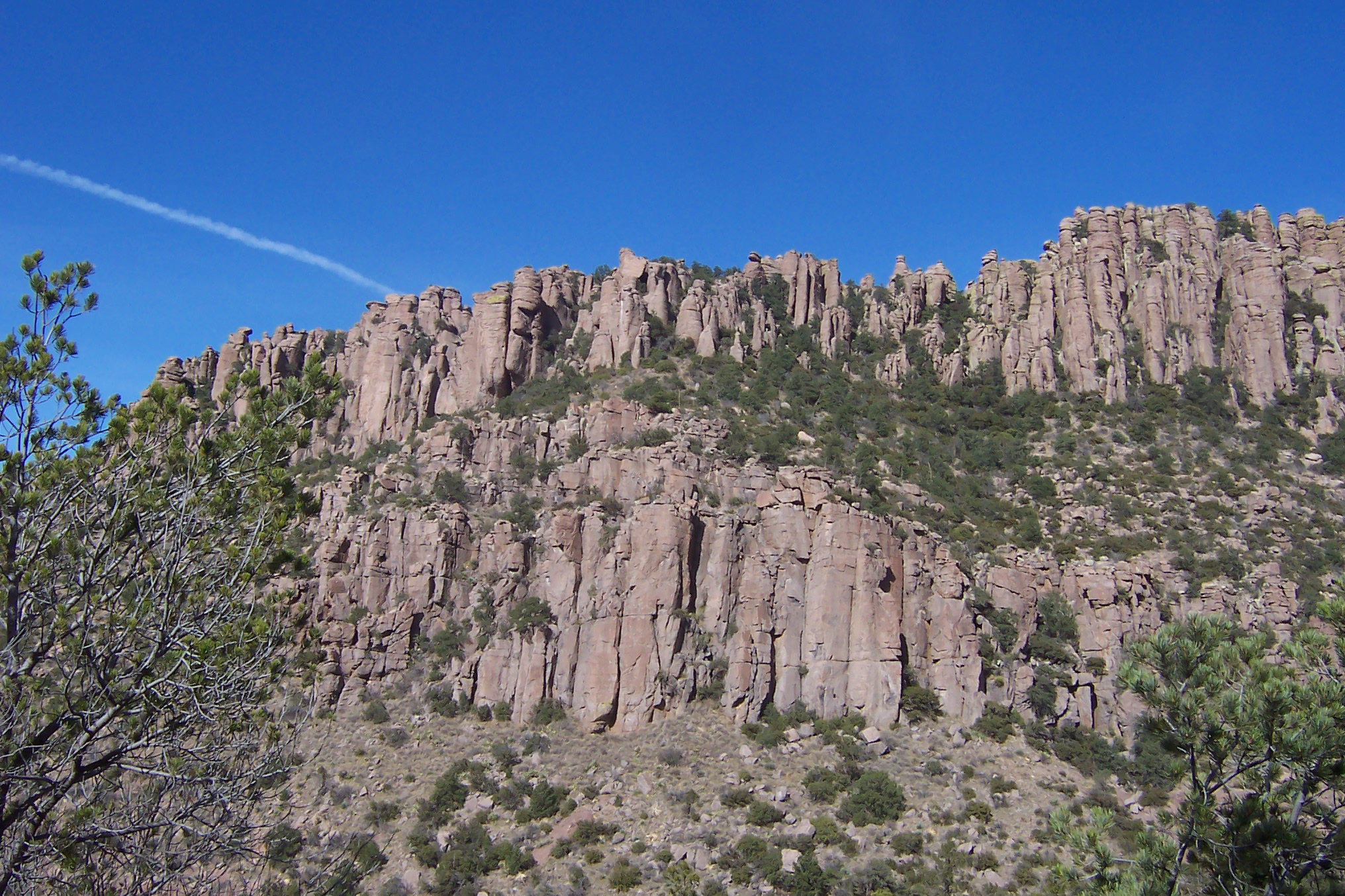
Echo Canyon to Visitor Center
2-4 HoursThis moderate, 4.2 mile/6.8 kilometer trail begins at Echo Canyon trailhead and consists of Echo Canyon, Upper Rhyolite Canyon, and Lower Rhyolite Canyon trails ending at the Visitor Center. It goes downhill through spectacular rock formations in Echo Canyon. The last half of the hike is in shaded oak woodlands. Make sure you have transportation back to your vehicle or ride the seasonal hikers' shuttle at 9:00 am.
Learn more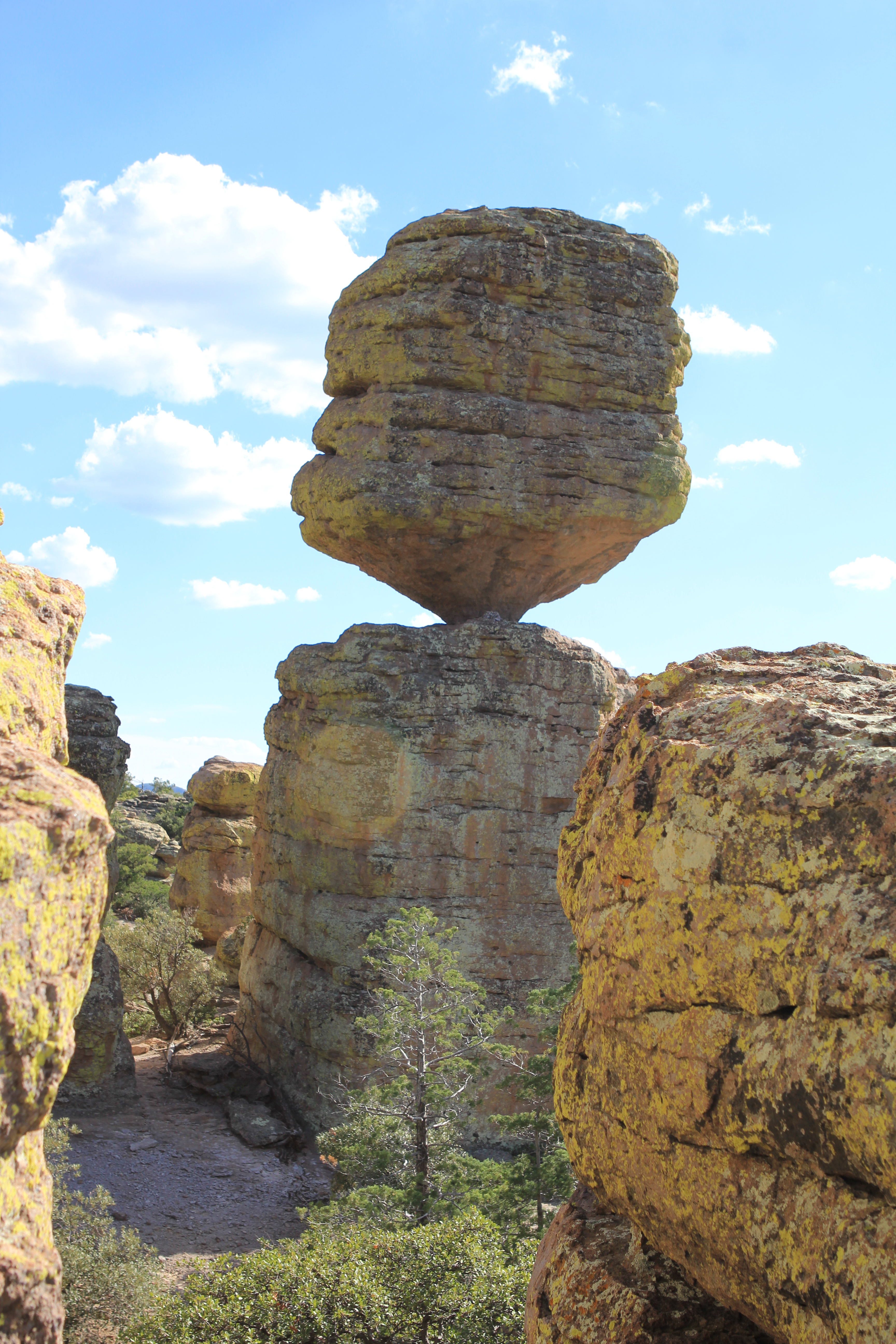
Heart of Rocks Loop
4-6 HoursThe Heart of Rocks Loop is a 7.3 mile/11.8 kilometer roundtrip hike to many of the most unusual rock formations in the monument, including Pinnacle Balanced Rock and Big Balanced Rock. Start the loop to the left and hike clockwise for the best views and easiest walking. Lots of rock steps make this a challenging loop, but it's worth the effort. There are three different ways to get to the loop, all of them being the same distance.
Learn more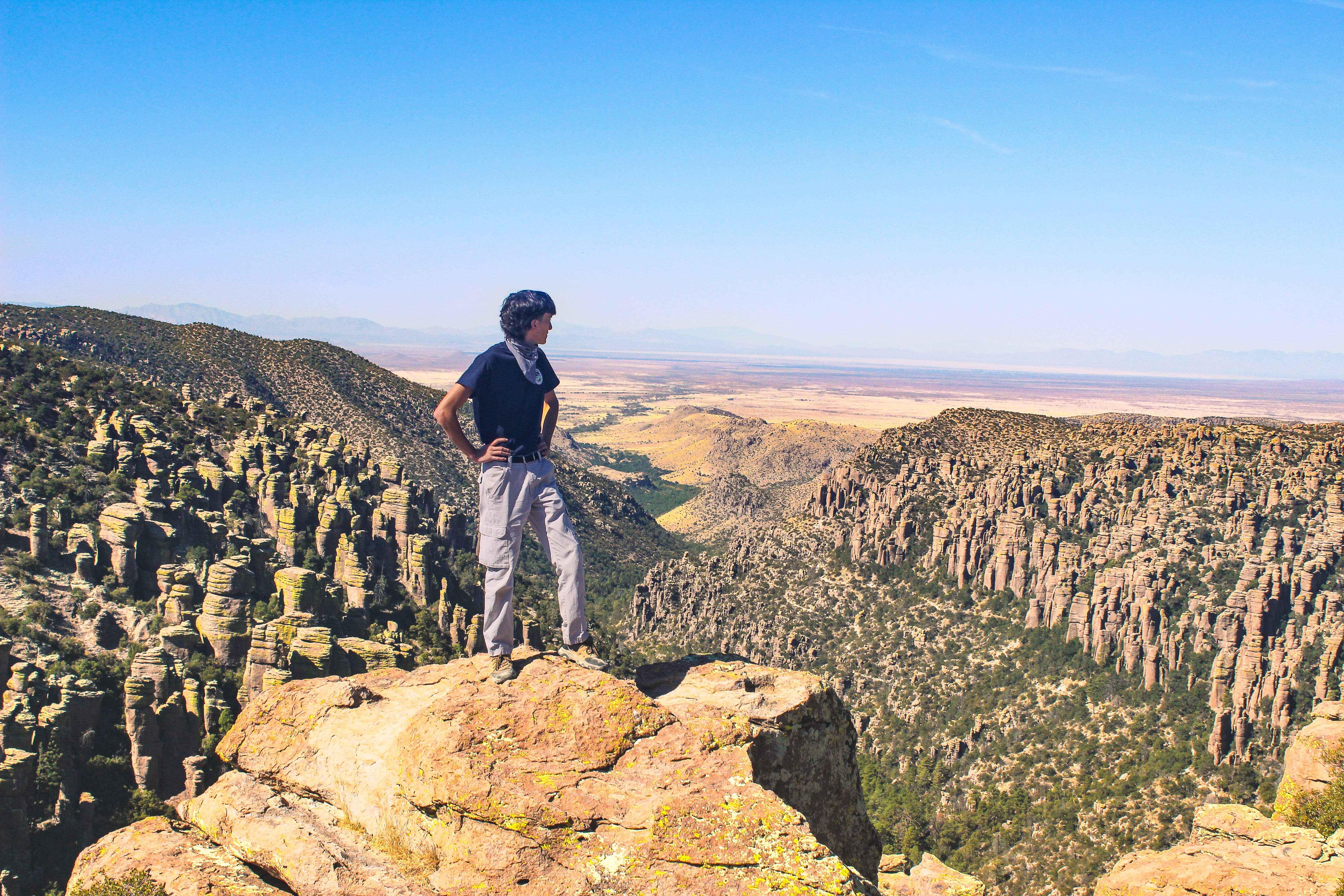
Hike the Trails at Chiricahua
1-9 Hours17 miles of trails will take you into a wilderness of rocks. Chiricahua offers a range of day hiking options from easy to strenuous.
Learn moreNo reviews yet. Be the first to share your experience!
Know a great spot near Chiricahua National Monument?
Help visitors discover the best local businesses near Chiricahua National Monument. List your business on Poyst and reach thousands of travelers.
- ✓Free business listing with photos & reviews
- ✓Appear in destination & city guides
- ✓Analytics dashboard to track visibility