2-4 Hours
Drive CO Highway 92
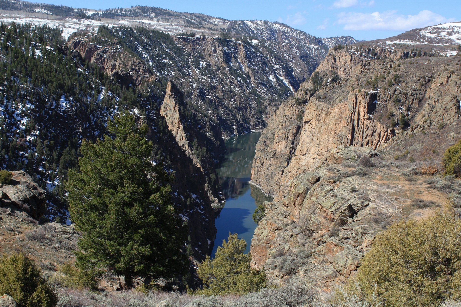
Curecanti National Recreation Area
Colorado (CO) Highway 92 crosses over Blue Mesa Dam and winds along the north rim of the Black Canyon, providing access to scenic overlooks and trailheads.
Colorado (CO) Highway 92 crosses over Blue Mesa Dam and winds along the north rim of the Black Canyon. There are a number of overlooks, as well as trailheads for those hoping to hike down to Morrow Point Reservoir or meander on the canyon rim. The road continues north towards Crawford, CO and the access road to the north rim of Black Canyon. Follow all posted speed limit signs. Be mindful of wildlife along the roadway, especially at dawn or dusk. Points of Interest Blue Mesa Dam Overlook Pioneer Point (Curecanti Creek Trailhead) Hermits Rest Crystal Creek Trailhead
Tags
Scenic DrivingCanyons and CanyonlandsDamsPlateaus and MesasGeologyLakesMountainsRiver and RiparianRock Landscapes and FeaturesScenic ViewsTransportationRoads, Routes and HighwayscurecantiCurecanti National Recreation Areablue mesa reservoirmorrow point reservoirgunnisonBlack Canyonblack canyon north rimscenic drivesColorado
Visitor Photos
No visitor photos yet
Details
Duration
2-4 Hours
Duration Details
This scenic drive can take between 2-4 hours. Visitors should plan for longer if they wish to stop at overlooks or hiking trailheads.
Fees Apply
No
Seasons
Winter, Spring, Summer, Fall
Time of Day
Day, Dawn, Dusk
Accessibility
CO Highway 92 is a paved state highway. There are wheelchair accessible restrooms along the way.
Pets
Yes — Leashed pets are allowed at overlooks, on trails, and at picnic areas.
Reservations
No
Location
CO Highway 92 and U.S. Highway 50 junction