2-4 Hours
Drive U.S. Highway 50
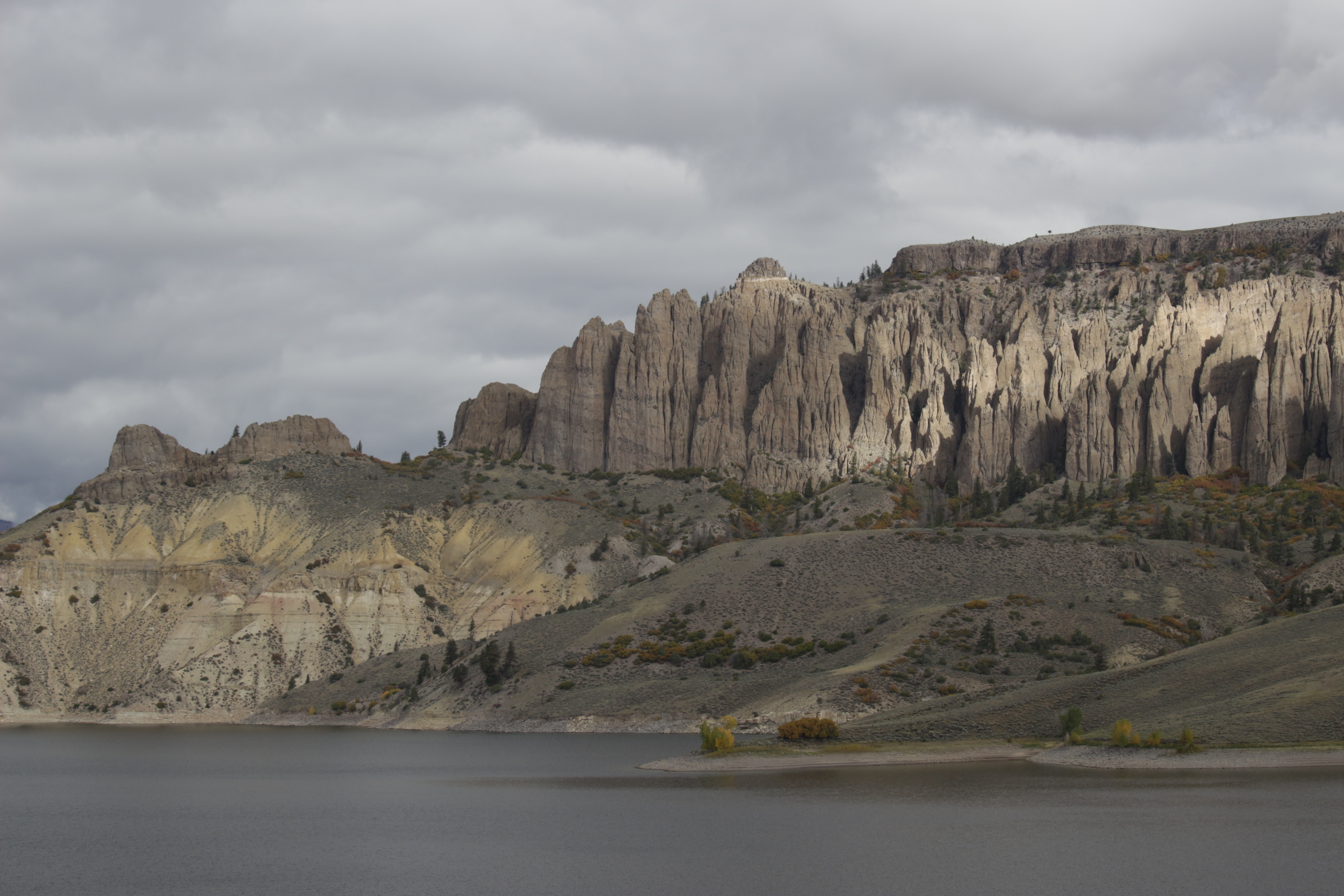
Curecanti National Recreation Area
U.S. Highway 50 travels west from Gunnison and brings you into Curecanti National Recreation Area. The highway follows along the Gunnison River before reaching Blue Mesa Reservoir, continuing along its edge and crossing two bridges.
U.S. Highway 50 travels west from Gunnison and brings you into Curecanti National Recreation Area. The highway follows along the Gunnison River before reaching Blue Mesa Reservoir. It continues onward along the reservoir edge before it junctions with CO Highway 92 after the Lake City Bridge. The highway goes over two small high elevation passes (Blue Mesa and Cerro Summit) and sharply meanders through Little Blue Creek Canyon. Follow all posted speed limit signs. Be mindful of wildlife along the roadway, especially at dawn or dusk. Points of Interest Cooper's Ranch Neversink Beaver Creek Lake City Bridge/Iola Basin Stevens Creek Campground and boat launch (hand-launched craft only) Elk Creek Visitor Center, marina, and campground Bay of Chickens Cebolla Basin Red Creek Dillon Pinnacles Lake Fork Marina and campground Pine Creek Trailhead Cimarron and Morrow Point Dam Past Cimarron, U.S. Highway 50 heads west to Montrose. Make sure to stop at the south rim of the Black Canyon of the Gunnison National Park, just a 5 mile drive north on CO Highway 347.
Tags
Scenic DrivingCanyons and CanyonlandsDamsPlateaus and MesasGeologyLakesRiver and RiparianRock Landscapes and FeaturesScenic ViewsRoads, Routes and HighwaysTrains and RailroadsCurecanti National Recreation Areacurecantiblue mesa reservoirgunnisonreservoirmorrow point reservoirscenic drivesColoradous highway 50
Visitor Photos
No visitor photos yet
Details
Duration
2-4 Hours
Duration Details
This scenic drive can take between 2-4 hours. There are a number of overlooks, picnic areas, and trailheads off U.S. Highway 50. For those wishing to stay overnight, there are seven campgrounds off this scenic drive.
Fees Apply
No
Seasons
Winter, Spring, Summer, Fall
Time of Day
Day, Dawn, Dusk
Accessibility
U.S. Highway 50 is a paved state highway. There are multiple wheelchair accessible restrooms along the way.
Pets
Yes — Leashed pets are allowed at overlooks, on trails, and at picnic areas.
Reservations
No
Location
U.S. Highway 50