2-3 Hours
In the Steps of Soldiers
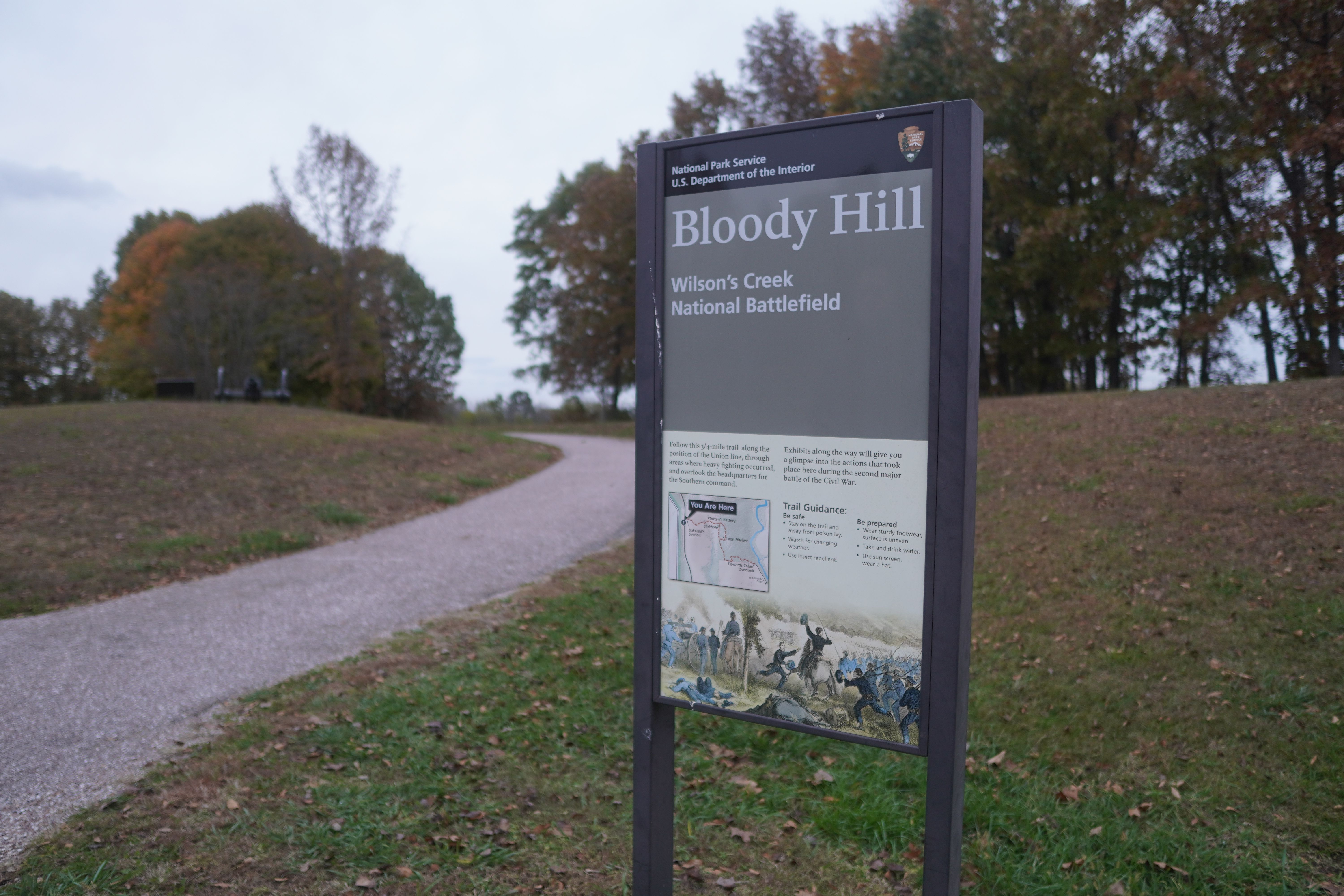
Wilson's Creek National Battlefield
Hike in the footsteps of Federal and Southern soldiers.
Hike in the footsteps of Federal and Southern soldiers on five walking trails varying in length between one-quarter and three-quarters of a mile. Travel along the Historic Wire Road, discover where General Lyon took his last stand on theBloody Hill Trail, or hike the rugged terrain of Manley Uplands Trail. Get your heart pumping as you traverse the Battlefield. Visit our trail map to find your next adventure.
Tags
Self-Guided Tours - WalkingBattlefieldswellness challengeHealthy Parks Healthy PeopleWilson's Creek National BattlefieldNational Park Weeksoldiers
Visitor Photos
No visitor photos yet
Details
Duration
2-3 Hours
Duration Details
Hiking Bloody Hill and trails can take anywhere from one hour to eight hours depending on your interest and hiking abilities. The park has over 10 miles of differently designated trails.
Fees Apply
No
Seasons
Spring
Time of Day
Day
Accessibility
The Visitor Center has three accessible parking spaces, and there is a paved sidewalk to its entrance. There is an accessible restroom, and it is all on one level. A wheelchair is available for use at the Visitor Center. The brochure is not available online, or in audio description format currently. The brochure is available in braille at the visitor center information desk. Please give us two weeks notice if you need an ASL Interpreter. A park staff member can provide live audio description if you provide us with two weeks advanced notice. Contact: Phone: 417-732-2662 Email: billie_aschwege@nps.gov Tour Road The length is 4.9 miles with a 150 ft elevation change. The one-way tour road is 18 feet wide. The left lane (12 feet wide) is for vehicles. The right lane is for pedestrians and bicycles. At each of the 8 stops, there are parking areas with designated accessible parking spaces. The waysides at Stop 1, Stop 3, Stop 4, and Stop 7 (Bloody Hill) are accessible The trails off the Tour Road are natural surfaces. The stops are not audio described at this time. Trail Information Gibson Mill: 1 mile and 40 ft elevation change Ray Cornfield: 1 mile and 80 ft elevation change (horses allowed) Ray House: Ray Springhouse: East Overlook: Pulaski Battery: Manley Uplands: 2.5 miles and 170 ft elevation change (horses allowed) Southwest: 1.7 miles and 140 ft elevation change (horses allowed) Wire Road: 1.7 miles and 150 ft elevation change (horses allowed) Bloody Hill: 0.5 mile and 60 ft elevation change Bloody Hill Spur: 0.5 mile and 100 ft elevation change Du Bois’s Battery: 0.25 mile and West Overlook: 0.25 mile and Learn more about accessibility at Wilson’s Creek National Battlefield. Pets are allowed at Wilson's Creek National Battlefield on a 6 foot leash. B. A. R. K Ranger Policies Bag your pet’s waste Always leash your pet Respect wildlife Know where you can go
Pets
Yes — Pets are welcome! Pets are allowed on a 6 foot leash and anywhere outdoors. If your pet is a service animal then it is allowed in the indoor buildings that are accessible to the public.
Reservations
No
Age Info
The age for hiking depends on the persons physical and mental abilities and the trails the person chooses to hike. All ages welcome!
Location
Bloody Hill